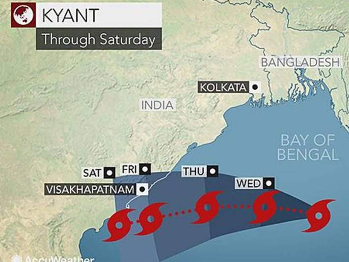
Tropical Cyclone ‘Kyant’ was located 680 km south-southeast of Gopalpur (Odisha) and 815 km east of Visakhapatnam yesterday.
Reportedly, it will unleash heavy rains and strong winds onto areas from western Myanmar to north-east India and Bangladesh. The newly formed storm will continue to the west and move farther onto the Bay of Bengal.

The cyclone will strengthen over the next few days and remain over the open ocean. The rain will expand towards the south worsening weather conditions in Visakhapatnam and Chennai with winds over 80 km/h within the 120 km where the cyclone will make its landfall. Kyant might stall near the coast this weekend before weakening. Kakinada, Ongole and Nellore have the highest risk of flooding.
The Indian Meteorological Department (IMD) has announced a wind warning along the Andhra Pradesh coast. Fishermen have been advised not to venture out to sea along the Odisha and Andhra Pradesh coasts. The cyclone will close in on its landfall on Saturday.
Despite latest reports stating that the cyclone might not touch Odisha at all but is most likely heading towards Visakhapatnam, Odisha remains on high alert.
Update
Cyclone Kyant is unlikely to make a landfall but coastal Andhra can still expect a wet Diwali. It’s intensity will increase in the next 24 hours, and it has moved further west-southwestward in the last six hours. Kyant is currently speeding at 70-80 kmph. It was earlier expected to move towards West Bengal and Odisha but it has changed direction. The cyclone will fade into deep depression on October 29. The sea conditions will still be rough and fisherman have been adviced not to venture out to sea from October 27.
The Name
The cyclone has been named ‘Kyant’ in Myanmar after after the Mon word for Crocodile.


Discussion about this post