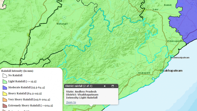
24 hours the day before in Visakhapatnam, Prakasam, Kurnool and Anantapur districts in coastal Andhra saw isolated rainfall. There was two cm of rainfall each in Chintapalle and Paderu in Visakhapatnam, Dornipadu in Kurnool, Chilamatur in Anantapur and one cm of rainfall each in Racherla, Araku Valley and Lepakshi.
The temperature today will likely be above normal by two or three degrees at isolated places in Rayalaseema. A north-south trough from North Central Maharashtra runs to South Tamil Nadu across the interiors of Karnataka, extending up to 0.9 KM above the mean sea level. It now runs from Telangana to South TN and extends up to 1.5 KM above mean sea level. Light to moderate rainfall/thundershowers were expected in the state.
The day before, temperatures were recorded at above normal at one of two places in Rayalaseema and coastal Andhra, with highest maximum temperature of 41 degrees recorded at Kadapa, Kurnool and Anantapur.
Yesterday’s temperatures in the state stood at Nandyal, Tirupati, Jangamaheswarapuram at 40 each, Nandigama at 39, Kavali, Nellore, Vijayawada at 38 each, Arogyavaram at 37, Kakinada, Tuni at 36 each, Machilipatnam, Ongole at 35 each, Bapatla, Narsapur, Visakhapatnam Airport at 34 each, Kalingapatnam at 32 and Visakhapatnam at 31.
The weather at Visakhapatnam now though stands at 35 degrees, with a hazy and humid weather predicted tonight with zero chance of thunderstorms or rainfall. Rainfall is however predicted in Visakhapatnam tomorrow and day after by the Indian Meteorological Department.


 *Feature Image used for representational purpose only.


Discussion about this post